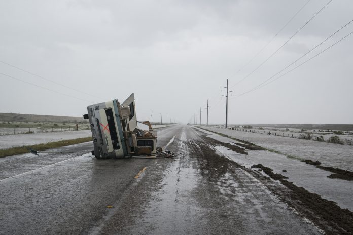
The record-shattering rains behind the flood catastrophe in southeast Texas will continue for several more days and have expanded into southwest Louisiana. Across this entire region, the National Hurricane Center is calling for 10 to 20 inches of new rainfall through Thursday.
Monday evening, Tropical Storm Harvey had drifted to the Texas coastline Monday and strengthened ever so slightly near the warm waters of the Gulf of Mexico. The Hurricane Center said the storm’s peak winds, had increased from 40 to 45 miles per hour. But it stressed rain, not wind, was expected to be the main hazard of concern.
Rain, which had eased some Friday morning, increased in coverage and intensity over the Houston area Monday afternoon and evening. At Houston Hobby Airport, more than seven inches had fallen Monday, a new record for the date.
Flash flood watches expanded as far east as New Orleans, where the Weather Service said 5 to 10 inches were possible through Thursday. Over an inch had fallen through Monday afternoon, pushing the summer’s rainfall total to the highest mark on record.
Through Monday evening, locations near Houston in Harris County had seen up to 37 inches of rain, with a county average of 33 inches. Isolated areas to the northeast had received up to 40 inches.
According to the National Weather Service, the forecast of more than a foot of additional rainfall in the Houston area “would have devastating consequences on the continuing rescue and recovery efforts.”
Some areas in southeast Texas could see storm rainfall totals exceeding 50 inches, which would break state records. An analysis by Eric Berger, a scientist who pens Houston weather blog, concluded Harvey is “almost certainly the biggest U.S. flood-producing storm” on record.
The astronomical rain totals had pushed river levels in Southeast Texas near and beyond record levels.
The Weather Service office serving Houston described the rain amounts so far “unfathomable.” The 16.07 inches that fell on Houston’s George Bush Airport on Sunday marks the single wettest day in Houston history, making up nearly a third of the 49.77 inches the city sees in an average year. More than two feet fell over the weekend, a record two-day amount.
Over the Houston metro area, so much rain would be expected to happen between just one time every 500 to 1,000 years.
The August rainfall in Houston, largely from Harvey, shattered its record for any month by a whopping 13.47 inches.
This flood disaster has easily surpassed the havoc wrought by the landmark Tropical Storm Allison in 2001, the Weather Service said.
Economic damage in the many billions of dollars is inevitable, according to economists and reinsurers.
As Harvey’s center gradually shifts over the Gulf of Mexico into Tuesday, some minor additional strengthening is possible, before again tracking onshore in the vicinity of Galveston Tuesday night.
The rainfall intensity in the Houston area will wax and wane through Thursday, but periods of excessive, flooding rainfall are possible, especially Tuesday into Wednesday. The heaviest rain is expected over the eastern part of the region.
Harvey’s motion will expose southern Louisiana to punishing rainfall as the outer rain bands train north and east over the western coastline of the Pelican State, from Lake Charles to Lafayette. In extreme southwest Louisiana, amounts could reach ten to 15 inches, resulting in severe flooding. Elsewhere, totals of around 6 to 10 inches are possible south of Interstate 10 through Thursday, with amounts tapering off quickly the farther north one goes.
Closer to Baton Rouge and the particularly susceptible New Orleans, a general five to seven inches with isolated 10-inch totals appear likely.
Upper-level steering currents will finally take hold of Harvey beginning Thursday and through much of Friday, driving it northward away from the Texas Gulf Coast, removing it from its fuel source and introducing the possibility of slow dissipation into the weekend. When that occurs, a lesser, more localized flash flood risk will exist late in the week between McAlester and Hugo, Oklahoma, extending farther eastward along the Ouachita Mountains into neighboring Arkansas.
A secondary threat will come in the form of scattered tornadoes, a danger that for the most part no longer encompasses the cities of Houston and Galveston. Instead, a Tornado Watch is up from far southeast Texas to New Orleans through 12:00 a.m. Tuesday.
Circulations within the training showers and thunderstorms rotating around Harvey could yield a chance of quick-hitting and short-lived spin-ups, adding insult to injury in places hit hard by flooding. Already, the National Weather Service in Houston has issued 155 Tornado Warnings over just the duration of Harvey, far more than they’ve ever issued in any given year.
(c) 2017, The Washington Post · Matthew Cappucci, Jason Samenow
{Matzav.com}


