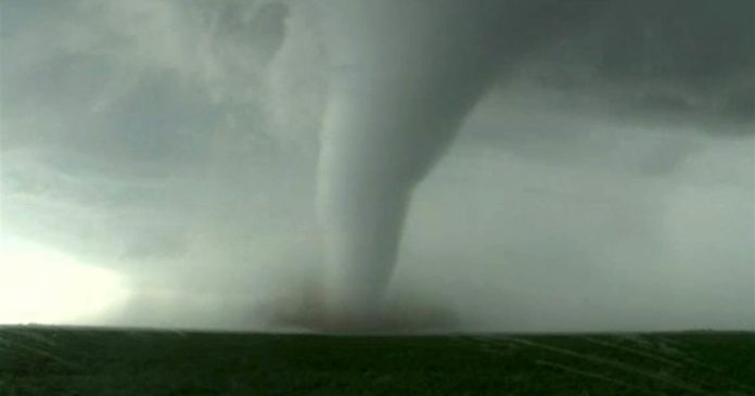
The past 10 days have featured a relentless stretch of severe weather across the central United States, and more nasty storms are in the cards across a broad region next week. Destructive tornadoes, damaging straight-line winds and large hail are probable over parts of Oklahoma, Kansas and Nebraska on Monday before the severe weather threat shifts east as the week wears on.
The National Weather Service Storm Prediction Center has already highlighted the region as having a Level 3 out of 5 “enhanced risk” of severe weather Monday from southern Oklahoma to southern Nebraska. Oklahoma City; Tulsa; Wichita; Topeka, Kan.; and Lincoln, Neb., are included in this zone. A Level 2 risk covers Kansas City and Omaha.
“Strong tornadoes, very large to giant hail, and damaging winds all appear possible,” the Storm Prediction Center wrote.
By Tuesday, at least some risk for severe storms will expand east from Des Moines to Chicago and south to Little Rock. An elevated risk area has been drawn for Wednesday too, and includes Waco, Tex.; Dallas; Little Rock; Nashville; Columbus; Indianapolis; Cincinnati; Louisville and St. Louis. It affects nearly 40 million people.
As it stands, 225 preliminary reports of tornadoes have been received over the past week and a half. A whopping 300 twisters were logged across the continental United States in April, the second most on record. Even Alaska had a brief tornado on April 19.
The weather pattern shows no signs of slowing any time soon. May is the historical peak of tornado season, and this one promises to get off to an extra-busy start.
– – –
Monday’s anticipated outbreak
It’s too early to say whether Monday will produce a tornado outbreak per se, but the Storm Prediction Center is already describing the possibility of a “severe-weather outbreak” in its online discussions. That’s a telltale sign that the potential exists for a serious severe weather event.
There are a number of ingredients that could come together to incite many dangerous storms:
– A strong high-altitude disturbance. Basically a pocket of cold air, low pressure and spin aloft, this upper-air disturbance will be the impetus for storms. It will slip over the Rockies on Monday morning before approaching the central and northern Plains on Monday evening. Storms will break out as its influence arrives. This same disturbance is energizing a significant storm in California this weekend.
– A well-defined dry line and very warm, humid air ahead of it. Storms like to form on boundaries where air masses clash. Beneath our high-altitude disturbance will be a pronounced dry line, or the border between warm, moisture-rich Gulf of Mexico air to the east and bone-dry air from the Desert Southwest. That sultry air mass (which could set records in the South) will be replete with instability, or storm fuel. As the disturbance moves overhead, storms will erupt on the dry line, which will be positioned somewhere near or just west of Interstate 35, a north-south highway, in central Oklahoma and Kansas, and reach up into eastern Nebraska.
– Wind shear. Wind shear, or a change of wind speed/direction with height, will be present. Southerly or south-southeasterly winds at the surface will contrast against strong southwesterly jet stream winds aloft. Storms that grow tall enough to blossom through multiple layers of atmosphere will feel those changing winds and rotate. That will increase the risk of strong tornadoes.
The areas of greatest risk, and the specific timing of storms, remain uncertain. That said, this is one of the more pronounced signals for a classic large-scale Great Plains severe weather outbreak in recent years. (Many of the tornado events in recent days have been more localized. This episode will probably be more geographically expansive.)
– – –
More storms Tuesday and Wednesday
As the cold front (and dry line) associated with this system pushes east into the midweek, more storms are likely. On Tuesday, parts of the Corn Belt, Midwest and even Ozarks are at play. By Wednesday, an enormous zone from northeast Texas, including Dallas, all the way to the northern Ohio Valley could be affected.
It’s far too early to offer any specific forecasts, but the same overarching upper-air disturbance will be moving east into a very warm and humid air mass. That’s a recipe ripe for storms.
How widespread and violent thunderstorms will be – and the hazards they’ll produce – is impossible to predict more than two to three days out. While ingredients will be present for severe weather, how they’ll combine is unclear at this point.
(c) Washington Post


At the onset of this disconcerting news story, it says “…before heading east.” Is the NY-NJ region subject to this difficult storm too?
DS not done yet. Planning another HAARP directed energy weapon.