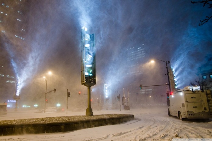
The brunt of the storm will occur overnight Friday into Shabbos, when snow is likely to be heavy at times. Winds will crank up by Saturday morning with gusts to 30-40 mph during the day, and higher near the Chesapeake Bay. The combination of snow and wind is likely to severely restrict visibility. Power outages are possible due to weight of the snow and strong winds.
This will be a long-duration event — around 36 hours, with snow potentially not ending until late Saturday night or even Sunday morning. Wherever you are Friday evening, it is quite possible you may need to remain there until Sunday or Monday, or even a bit longer.
Snow totals could be historic depending on the final storm track. We think 12-20 inches is reasonable first estimate for the immediate metro area, with higher amounts of up to 2 feet or so in our colder areas, north and west of line from roughly Warrenton to Fairfax to Rockville to Columbia. Somewhat lesser amounts may fall southeast of the Beltway, more on the order of 8-16 inches.
Here are the chances of different amounts for the immediate metro area:
At least one inch: 95 percent or higher
At least four inches: 85 percent
At least eight inches: 75 percent
At least 12 inches: 65 percent
At least 18 inches: 40 percent
At least 24 inches: 15 percent
Locations west of that Warrenton to Columbia line can add 5-10 percent to probabilities of at least 8 to 24 inches.
Storm scenarios
Scenario 1: Paralyzing snow amounts, 75 percent chance
The scenario that is most likely to play out is one that is likely to cripple the city. All the operational models last night and so far today have featured a low tracking across the South and then strengthening off the Mid-Atlantic coast with higher pressure to our north to keep cold air funneling southward into the region as the storm approaches.
This scenario would produce accumulations that could rival the two biggest storms of the 2009-2010 Snowmageddon season. One to 2 foot accumulations would be likely with such a scenario and some locations might reach 30 inches.
The Canadian, GFS, European, Canadian and NAM models plastered the area with such a storm. All not only predict significant snow but also predict strong winds suggesting some locations could feel blizzard conditions. Travel Friday night and Saturday would probably come to standstill.
The cold stretch we’ve been in means that roads will be cold so snow will quickly accumulate on them.
Locations south and east of the city still look like they would have a period of sleet or might briefly mix snow with sleet but then would likely turn back to snow before the storm exited the region Saturday night or early Sunday.
The combination of strong winds and wet snow could lead to scattered outages. Gale conditions are likely over the Bay.
The NAM model shows conditions that may support thundersnow Saturday morning.
The biggest bones of contention are when the snow will start and end across the area and who will end up in the stripe of heaviest snow.
We tend to favor northwest Virginia near the I-81 corridor as a likely bulls-eye, although today’s GFS model puts it smack over the District.
The uncertainty of the timing is illustrated by the spread of the low forecast positions from last night’s GFS ensemble. Each low represents where one of the ensemble members predicted the low to be at 1 a.m. Saturday morning. Note that all have the low clustered tightly along an ideal track to give the area a major snowstorm, but the low positions vary from being along the coast of South Carolina to north of Cape Hatteras North Carolina.
The same type of timing differences are present in the operational models. The GFS operational model brings the snow into the western Suburbs by mid-morning Friday and into the city by early afternoon. By contrast, last night’s European model doesn’t get the snow into city until sometime between 4 and 7 p.m. Friday. Both models suggest this will be a long duration storm lasting into Saturday night or even Sunday morning.
Last night’s European ensemble members illustrate how much consensus there is for this being an extreme storm and again suggest that the storm could rival some of the all-time greats.
The figures below show the percentage of the 50 European ensemble members that produced at least 12 inches of snow (top panel) and 24 inches of snow (bottom panel).
The European snow product tends to be a little aggressive, but still, it’s an impressive display of how much potential this storm has to produce big-league snow totals.
The ensembles suggest that the jackpot for snow will probably be somewhere in northwestern Virginia but in reality it could be almost anywhere west of the city where the green shades are depicted. My guess is someone will see 30 inches of snow, but it will be focused along one of those banded type features that the models don’t forecast the location of very well in advance.
Scenario 2: Non-crippling winter storm (25 percent chance)
The second scenario encompasses possible variations in which the storm track shifts just enough to change the evolution of how the storm would play out over our area. Either of these possibilities would still offer the city heavy snow but yield more manageable totals on the order of 6 to 12 inches.
If the storm were to track north of Norfolk, Va., and then across the Delmarva Peninsula, the snow in Washington would mix with or change to sleet and/or rain which would keep snow totals in the city down and would really put the kibosh on snow accumulations in Southern Maryland. However, locations west of the city, especially along the I-81 corridor, would get crushed and could still end up with snow totals measuring in feet.
The other possibility is that the storm track shifts east. Then the D.C. area would stay all snow but might only end up with 6 to 12 inches while locations south and east like St Mary’s and Calvert counties might end up with a jackpot of snow and record well over a foot, while the far western suburbs end up with the least snow in the area. To us, that’s the least likely possibility. In each of these storm iterations, travel would still be a mess Friday night into Shabbos but the city would probably spring back to normal by Monday.
(c) The Washington Post
{Matzav.com Newscenter}


This is misleading. It’s referring to the city of Washington, not New York. Plz take this one down and give us the NY prediction. Thank you.